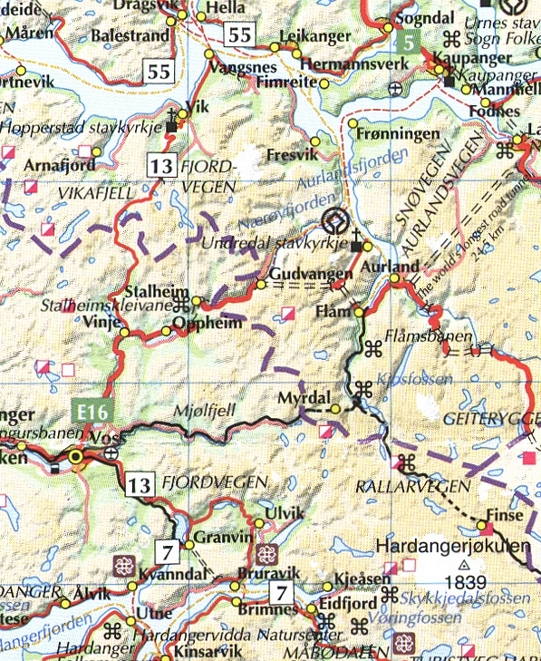
The Sognefjord is the horizontal stretch of water towards the top of the map. The Aurlandsfjord descends south from it and ends at Flam. The Naeroyfjord turns east from this and ends at Gudvangen.
This map is a small extract from the Norwegian tourist brochure "Fjord Norway" .The producers of which have a website www.fjordnorway.com
Rev 080809